Notice: AZYavapaiHub.info is an information reference resource only, and is not an official Yavapai County Government website.
- YAVAPAI COUNTY INFORMATION RESOURCES -
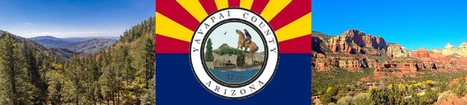
Your Source For Information About Yavapai County Arizona
YAVAPAI COUNTY USGS TOPOGRAPHIC MAP INDEX:
To download maps select from the list of links down below
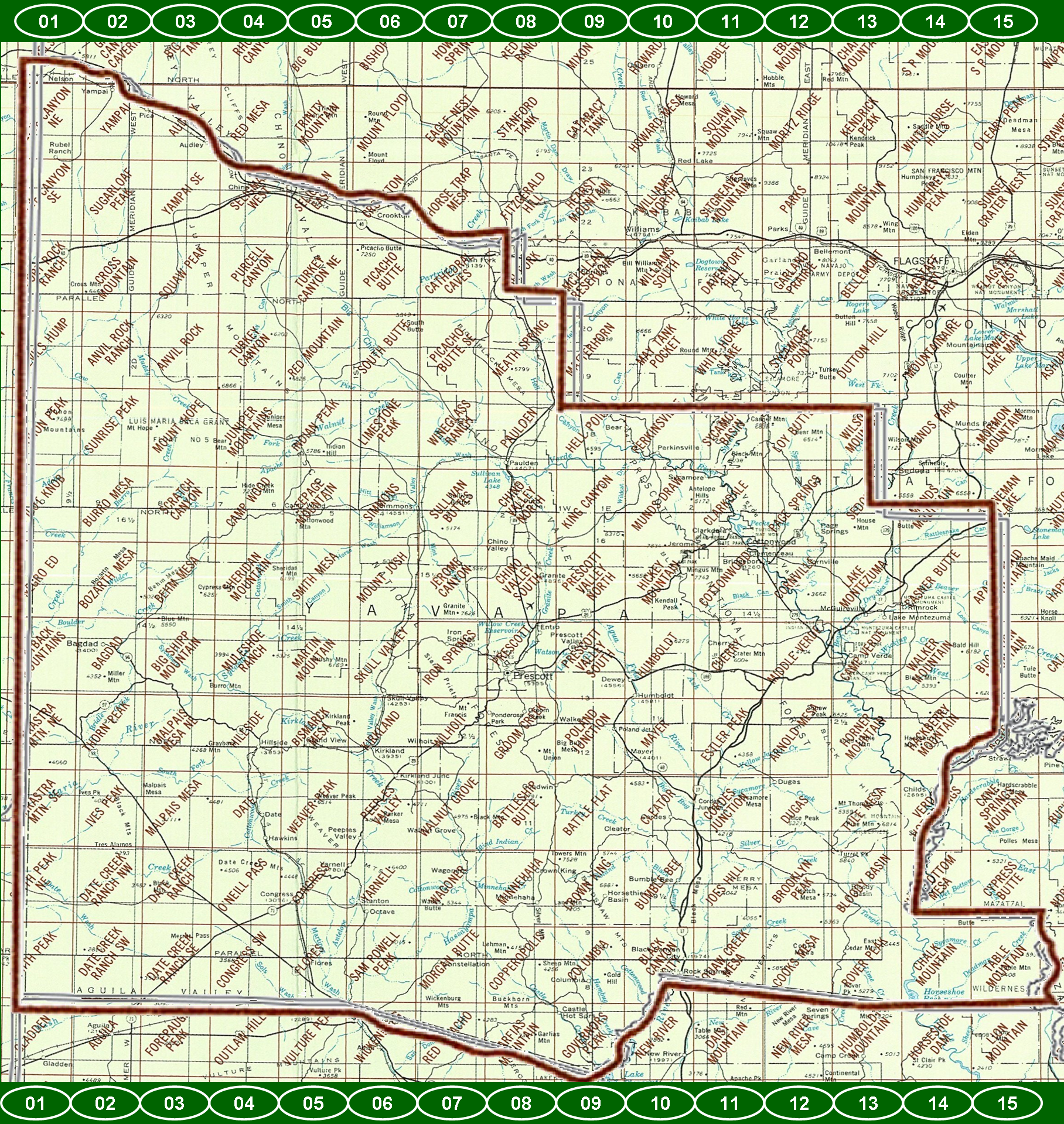
USGS TOPOGAPHIC QUADRANT MAPS FOR YAVAPAI COUNTY
TNM GEOSPATIAL PDF Scale: 1:24,000 7.5 X 7.5 GRID 24000
(Download maps from links below and you can also download more or order paper copies directly from from USGS)
COLUMN-01:
- Blye Canyon NE - [ Order Maps ]
- Blye Canyon SE - [ Order Maps ]
- Fort Rock Ranch - [ Order Maps ]
- Devils Hump - [ Order Maps ]
- Mohon Peak - [ Order Maps ]
- Pilot Knob - [ Order Maps ]
- Negro Ed - [ Order Maps ]
- Grayback Mountains - [ Order Maps ]
- Arrastra Mountain NE - [ Order Maps ]
- Arrastra Mountain SE - [ Order Maps ]
- Smith Peak NE - [ Order Maps ]
- Smith Peak - [ Order Maps ]
COLUMN-02:
- Yampai - [ Order Maps ]
- Sugarloaf Peak - [ Order Maps ]
- Cross Mountain - [ Order Maps ]
- Anvil Rock Ranch - [ Order Maps ]
- Sunrise Peak - [ Order Maps ]
- Burro Mesa - [ Order Maps ]
- Bozarth Mesa - [ Order Maps ]
- Bagdad - [ Order Maps ]
- Thorn Peak - [ Order Maps ]
- Ives Peak - [ Order Maps ]
- Date Creek Ranch NW - [ Order Maps ]
- Date Creek Ranch SW - [ Order Maps ]
COLUMN-03:
- Audley - [ Order Maps ]
- Yampai SE - [ Order Maps ]
- Squaw Peak - [ Order Maps ]
- Anvil Rock - [ Order Maps ]
- Mount Hope - [ Order Maps ]
- Scratch Canyon - [ Order Maps ]
- Behm Mesa - [ Order Maps ]
- Big Shipp Mountain - [ Order Maps ]
- Malpais Mesa NE - [ Order Maps ]
- Malpais Mesa - [ Order Maps ]
- Date Creek Ranch - [ Order Maps ]
- Date Creek Ranch SE - [ Order Maps ]
COLUMN-04:
- Seligman West - [ Order Maps ]
- Purcell Canyon - [ Order Maps ]
- Turkey Canyon - [ Order Maps ]
- Juniper Mountains - [ Order Maps ]
- Camp Wood - [ Order Maps ]
- Sheridan Mountain - [ Order Maps ]
- Muleshoe Ranch - [ Order Maps ]
- Hillside - [ Order Maps ]
- Date - [ Order Maps ]
- O'Neill Pass - [ Order Maps ]
- Congress SW - [ Order Maps ]
COLUMN-05:
- Selegman East - [ Order Maps ]
- Turkey Canyon NE - [ Order Maps ]
- Red Mountain - [ Order Maps ]
- Indian Peak - [ Order Maps ]
- Seepage Mountain - [ Order Maps ]
- Smith Mesa - [ Order Maps ]
- Martin Mountain - [ Order Maps ]
- Bismarck Mesa - [ Order Maps ]
- Weaver Peak - [ Order Maps ]
- Congress - [ Order Maps ]
- Flores - [ Order Maps ]
COLUMN-06:
- Crookton - [ Order Maps ]
- Picacho Butte - [ Order Maps ]
- South Butte - [ Order Maps ]
- Limestone Peak - [ Order Maps ]
- Simmons - [ Order Maps ]
- Mount Josh - [ Order Maps ]
- Skull Valley - [ Order Maps ]
- Kirkland - [ Order Maps ]
- Peeples Valley - [ Order Maps ]
- Yarnell - [ Order Maps ]
- Sam Powell Peak - [ Order Maps ]
COLUMN-07:
- Cathedral Caves - [ Order Maps ]
- Picacho Butte SE - [ Order Maps ]
- Wineglass Ranch - [ Order Maps ]
- Sullivan Buttes - [ Order Maps ]
- Jerome Canyon - [ Order Maps ]
- Iron Springs - [ Order Maps ]
- Wilhoit - [ Order Maps ]
- Walnut Grove - [ Order Maps ]
- Wagoner - [ Order Maps ]
- Morgan Butte - [ Order Maps ]
- Red Picacho - [ Order Maps ]
COLUMN-08:
- Ash Fork - [ Order Maps ]
- Meath Spring - [ Order Maps ]
- Paulden - [ Order Maps ]
- Chino Valley North - [ Order Maps ]
- Chino Valley South - [ Order Maps ]
- Prescott - [ Order Maps ]
- Groom Creek - [ Order Maps ]
- Battleship Butte - [ Order Maps ]
- Minnehaha - [ Order Maps ]
- Copperopolis - [ Order Maps ]
- Garfias Mountain - [ Order Maps ]
COLUMN-09:
- Matterhorn - [ Order Maps ]
- Hell Point - [ Order Maps ]
- King Canyon - [ Order Maps ]
- Prescott Valley North - [ Order Maps ]
- Prescott Valley South - [ Order Maps ]
- Poland Junction - [ Order Maps ]
- Battle Flat - [ Order Maps ]
- Crown King - [ Order Maps ]
- Columbia - [ Order Maps ]
- Governors Peak - [ Order Maps ]
COLUMN-10:
- Perkinsville - [ Order Maps ]
- Munds Draw - [ Order Maps ]
- Hickey Mountain - [ Order Maps ]
- Humboldt - [ Order Maps ]
- Mayer - [ Order Maps ]
- Cleater - [ Order Maps ]
- Bumble Bee - [ Order Maps ]
- Black Canyon City - [ Order Maps ]
- New River - [ Order Maps ]
COLUMN-11:
- Sycamore Basin - [ Order Maps ]
- Clarkdale - [ Order Maps ]
- Cottonwood - [ Order Maps ]
- Cherry - [ Order Maps ]
- Estler Peak - [ Order Maps ]
- Cordes Junction - [ Order Maps ]
- Joes Hill - [ Order Maps ]
- Squaw Creek Mesa - [ Order Maps ]
COLUMN-12:
- Loy Butte - [ Order Maps ]
- Page Springs - [ Order Maps ]
- Cornville - [ Order Maps ]
- Middle Verde - [ Order Maps ]
- Arnold Mesa - [ Order Maps ]
- Dugas - [ Order Maps ]
- Brooklyn Peak - [ Order Maps ]
- Cooks Mesa - [ Order Maps ]
COLUMN-13:
- Wilson Mountain - [ Order Maps ]
- Sedona - [ Order Maps ]
- Lake Montezuma - [ Order Maps ]
- Camp Verde - [ Order Maps ]
- Horner Mountain - [ Order Maps ]
- Tule Mesa - [ Order Maps ]
- Bloody Basin - [ Order Maps ]
- Rover Peak - [ Order Maps ]
COLUMN-14:
- Munds Mountain - [ Order Maps ]
- Casner Butte - [ Order Maps ]
- Walker Mountain - [ Order Maps ]
- Hackberry Mountain - [ Order Maps ]
- Verde Hot Springs - [ Order Maps ]
- Wet Bottom Mesa - [ Order Maps ]
- Chalk Mountain - [ Order Maps ]
COLUMN-15:
- Stoneman Lake - [ Order Maps ]
- Apache Maid Mountain - [ Order Maps ]
- Buckhorn Mountain - [ Order Maps ]
- Strawberry - [ Order Maps ]
- Cane Springs Mountain - [ Order Maps ]
- Table Mountain - [ Order Maps ]
[ Order More From The USGS Map Store ]
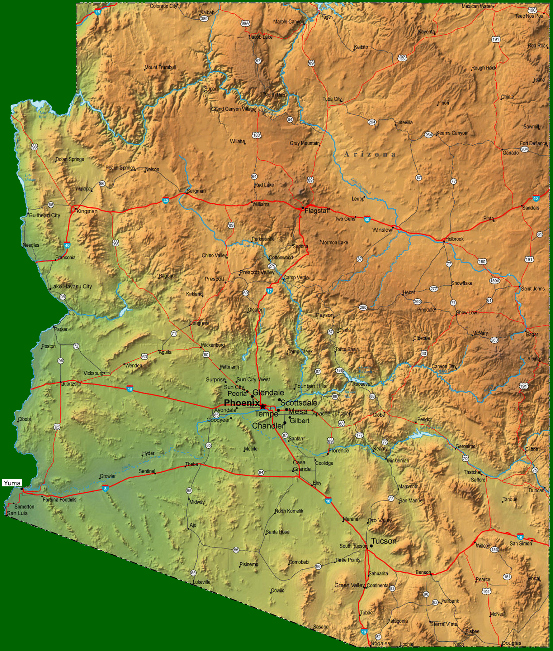
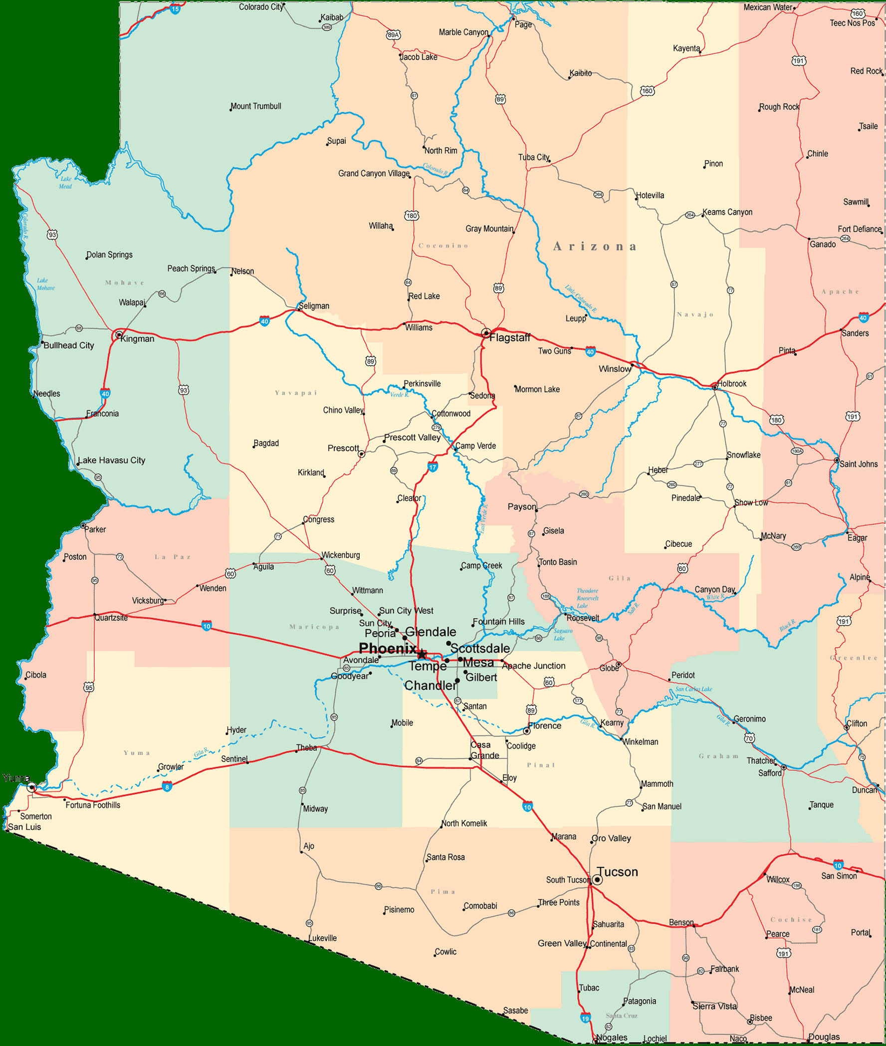
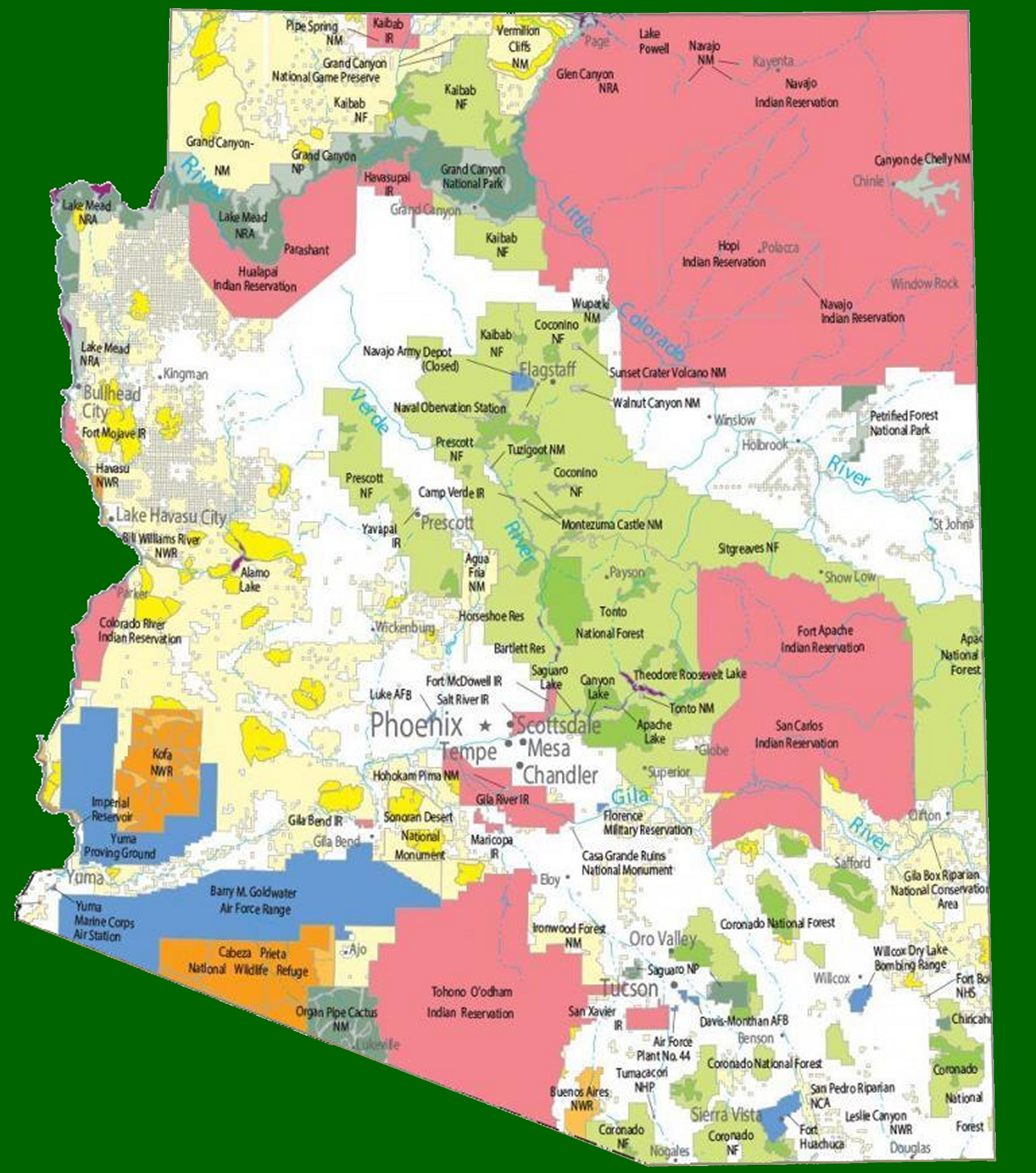
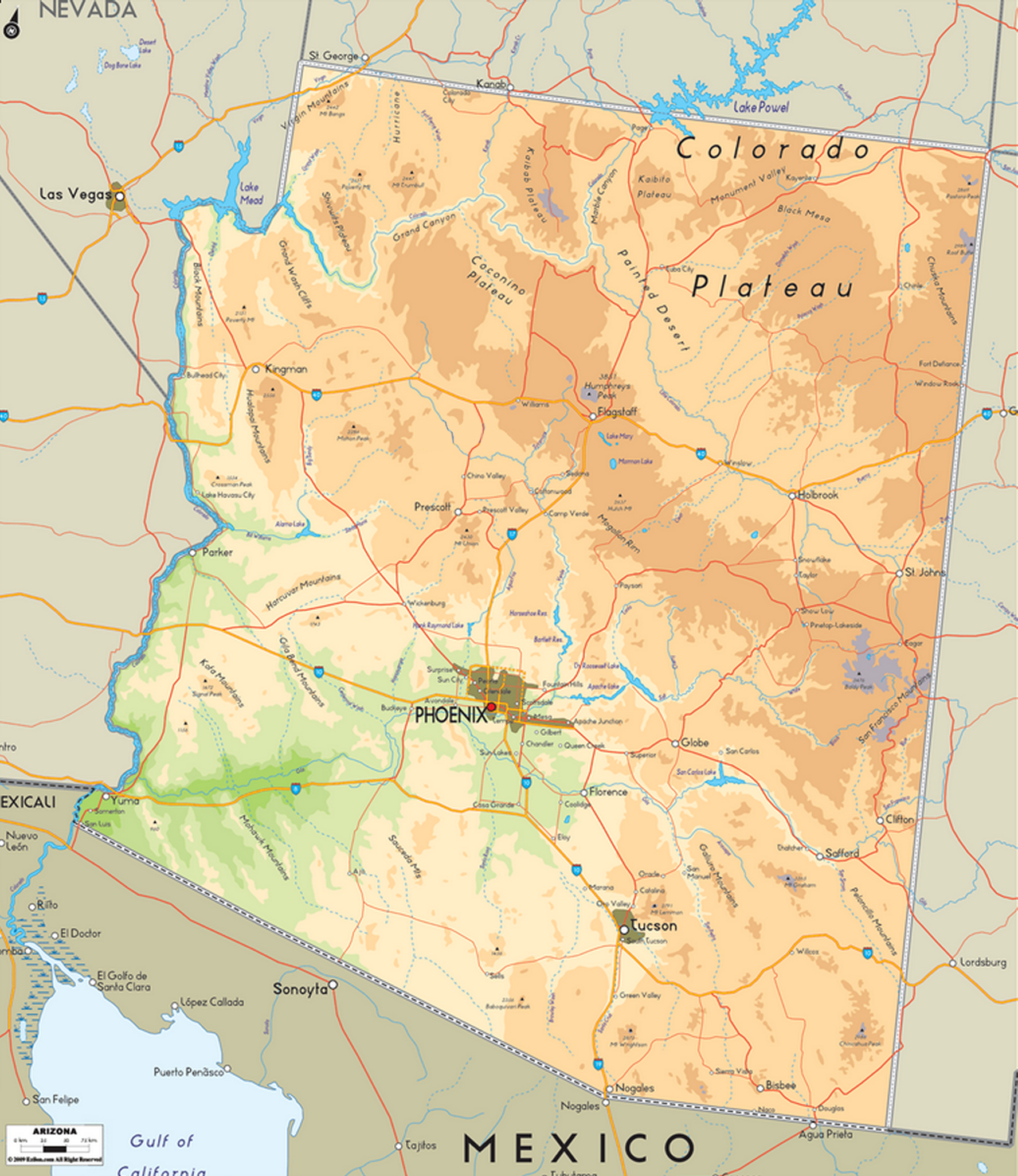
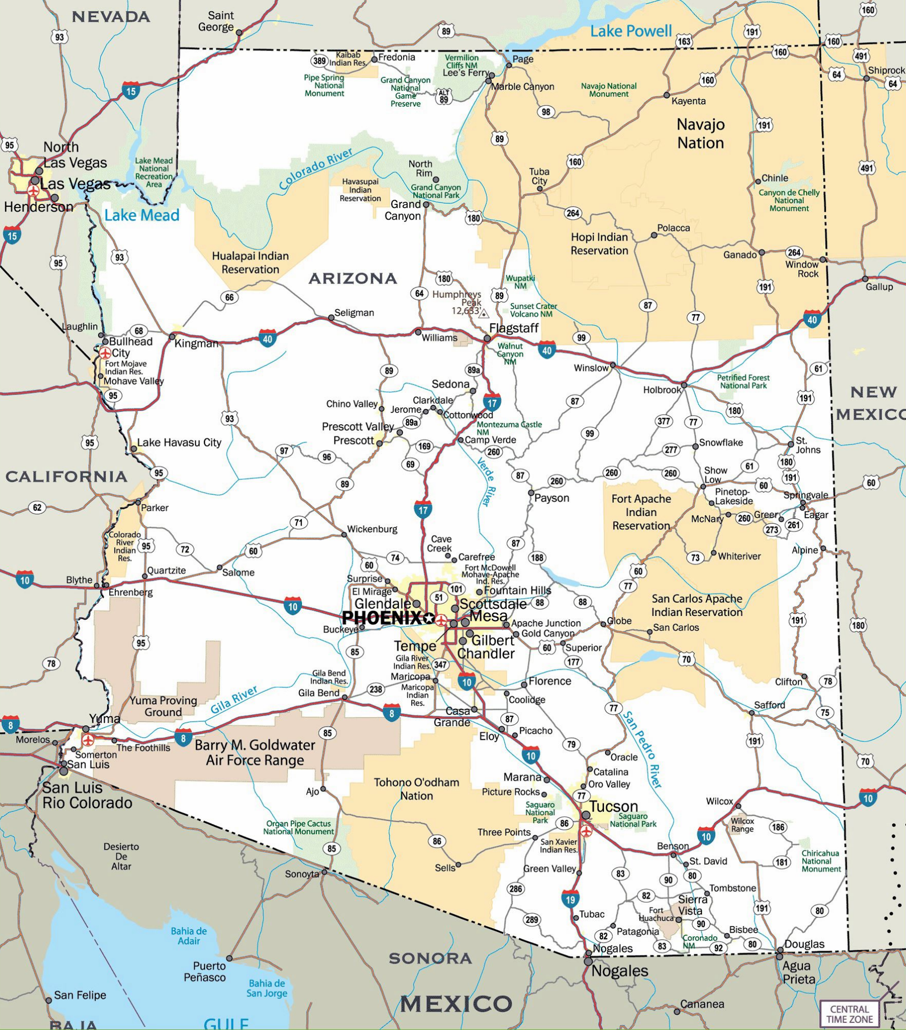
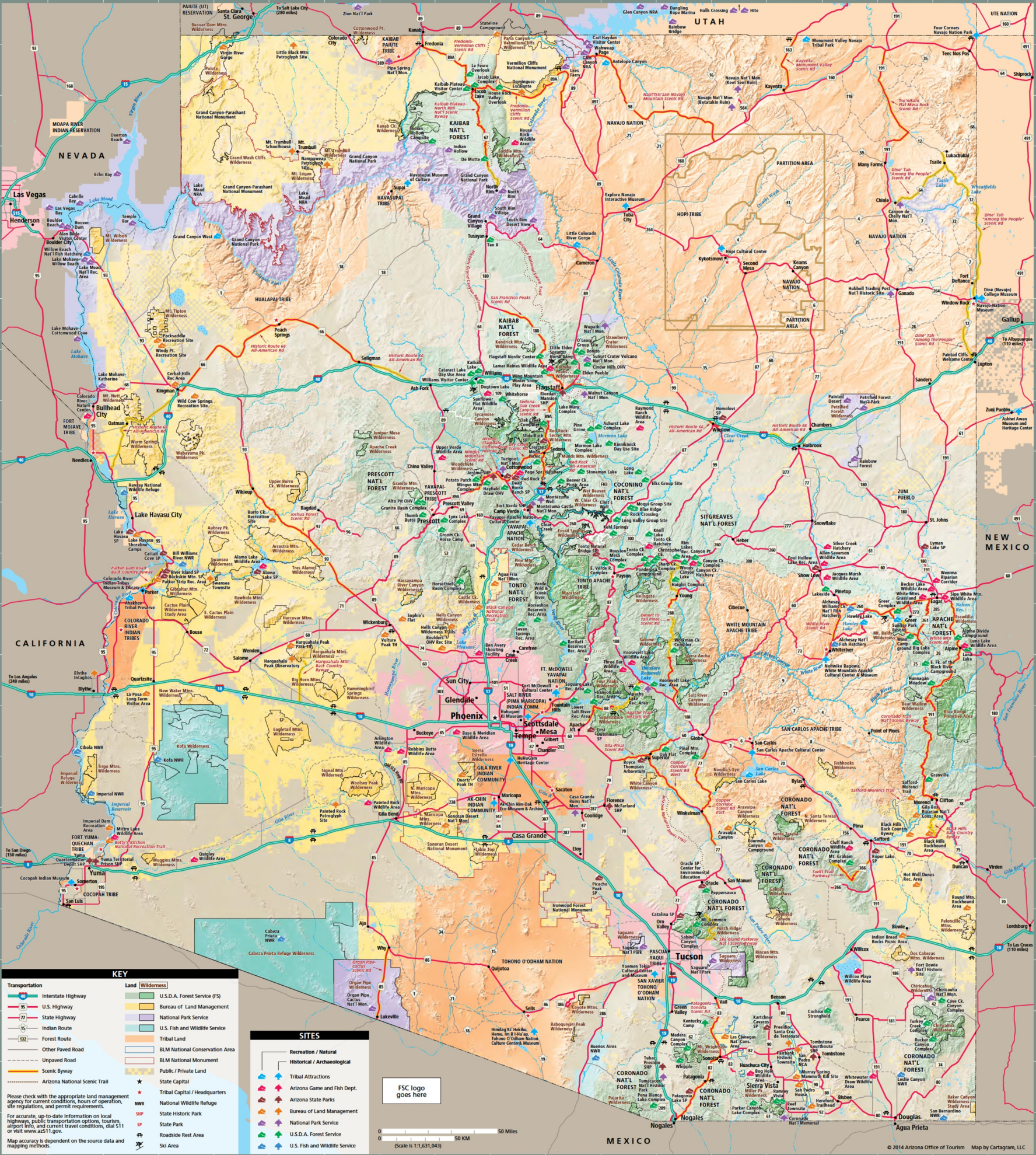
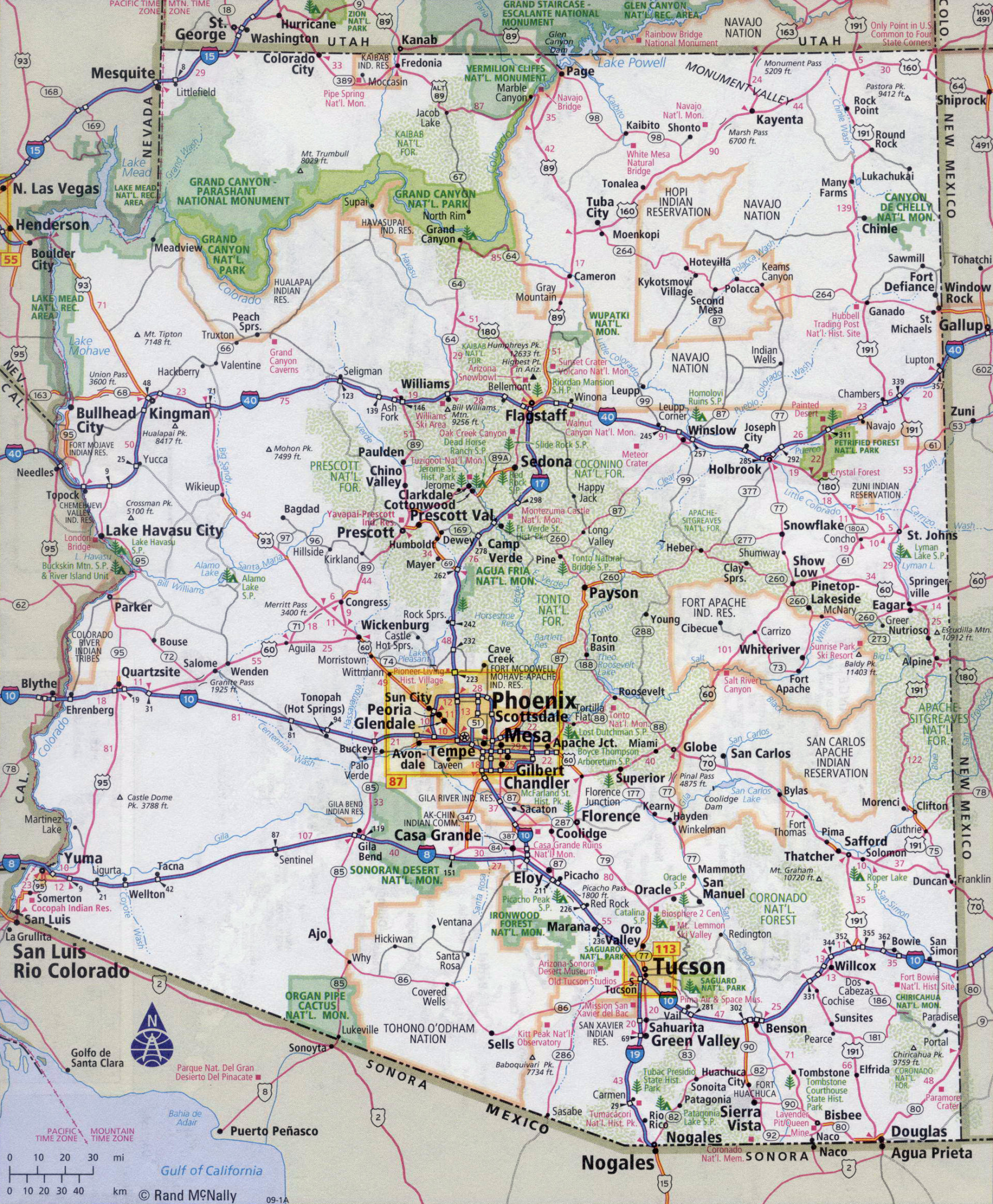
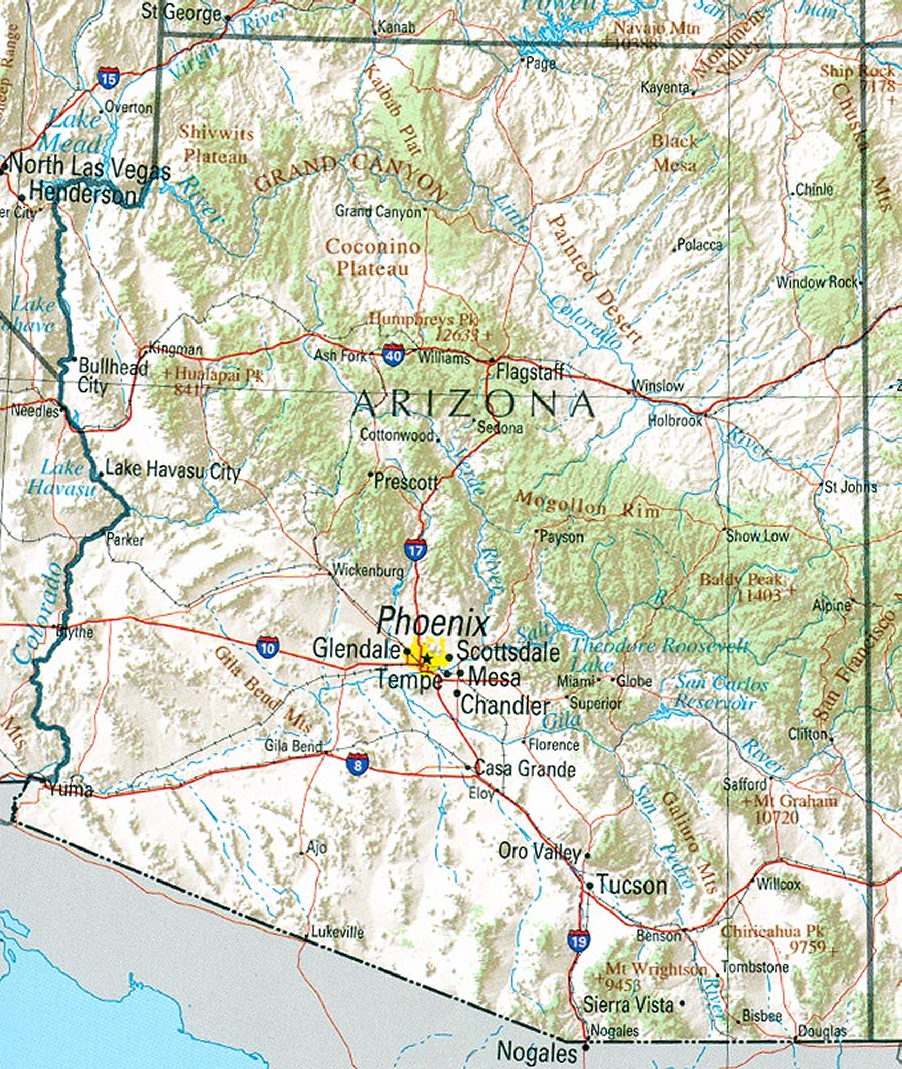
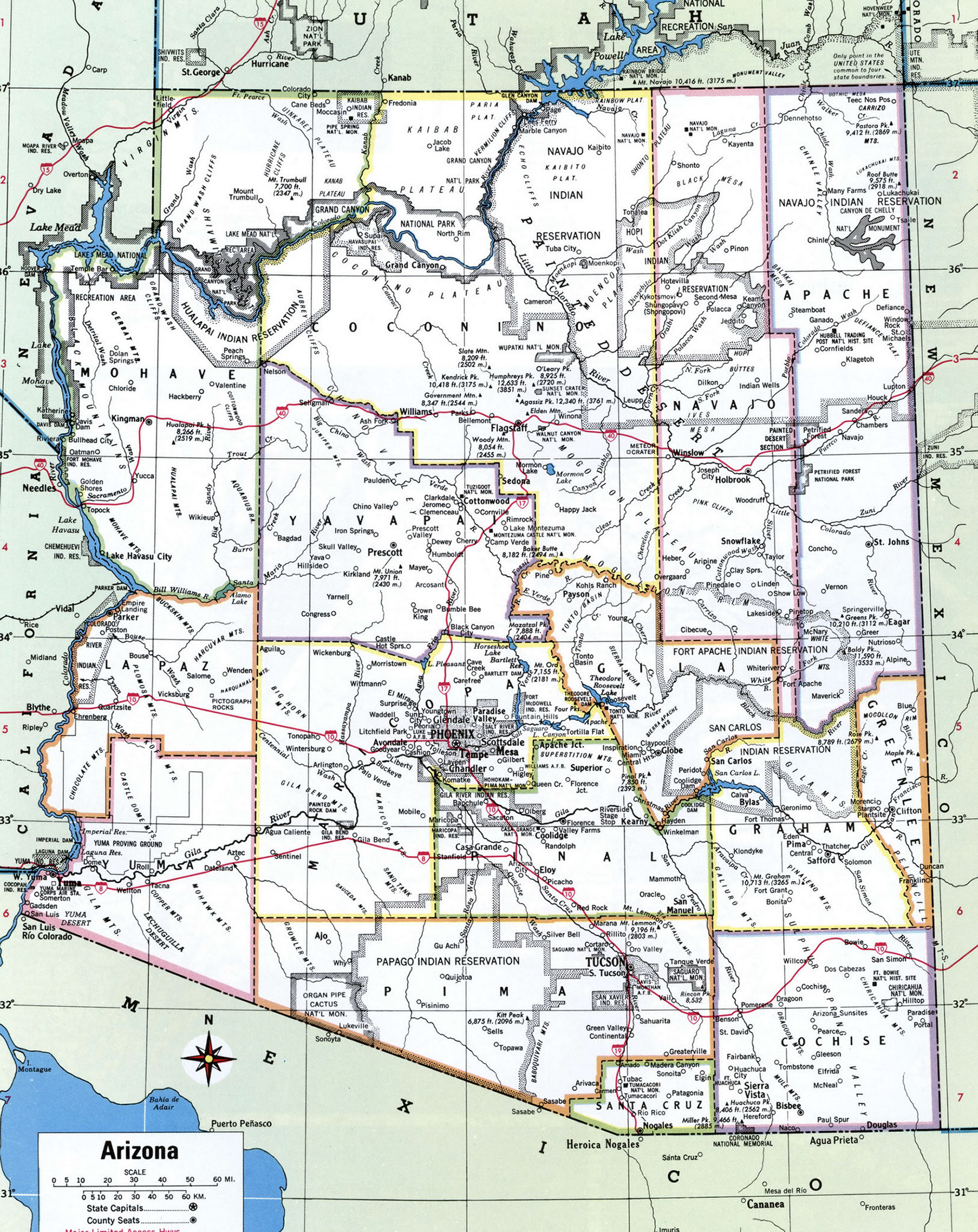
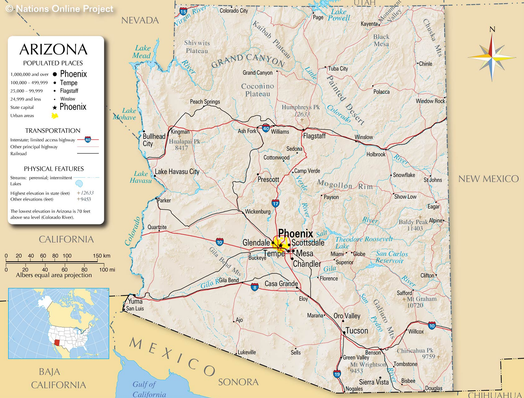
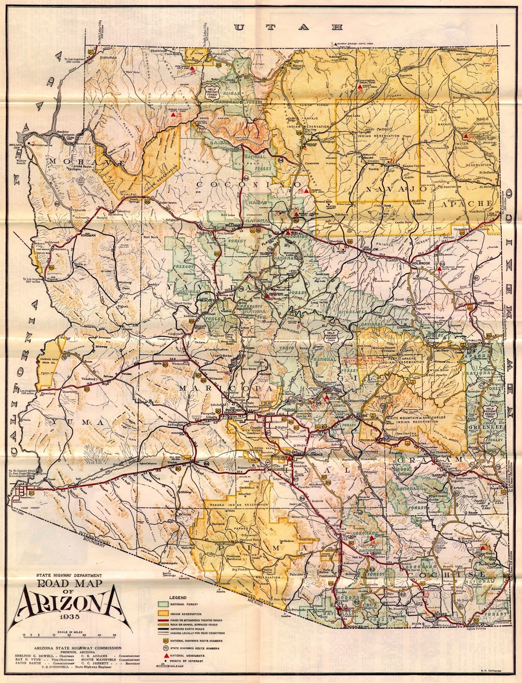
VARIOUS TYPES OF REPRESENTATIVE MAPS OF THE STATE OF ARIZONA
[ Download USGS Arizona State Relief Map ]

[ Return to Top ]

For any changes or corrections that need
to be made, or suggestions for additions,
just copy-paste and send an email to:
AZYavapaiHub@protonmail.com